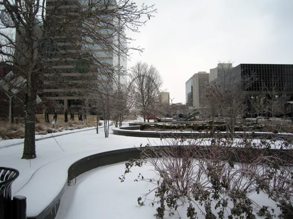
What Monday’s commute looks like in St. Louis after weekend snow and dangerous cold
Road crews continue cleanup as temperatures plunge
St. Louis begins the workweek on Monday, Jan. 26, 2026, with the region transitioning from active snowfall to recovery mode. The weekend system brought heavy snow across portions of eastern Missouri and southwest Illinois, and the most immediate challenge for commuters is not only lingering accumulation but also extreme cold that slows melting and can preserve slick spots on pavement.
Transportation agencies have warned that road conditions can remain hazardous well after snowfall ends, particularly with wind-driven drifting and reduced visibility in open areas. Bitter temperatures also reduce the effectiveness of salt treatment, increasing the likelihood that compacted snow and ice remain on travel lanes and on untreated surfaces.
Major routes prioritized, but secondary roads may lag
Snow-removal operations typically focus first on interstates and other high-volume corridors, then move to major state routes and, later, lower-volume roadways. That means drivers may encounter improved conditions on primary routes earlier than on neighborhood streets and less-traveled connectors—especially in hilly areas, at curves, and at intersections where traction issues are more common.
Elevated surfaces such as bridges, ramps, and overpasses are likely to stay slick longer than surrounding pavement. Commuters should also expect narrowed lanes in areas where plowed snow reduces shoulder width or blocks turn lanes.
City services and schedules are disrupted across the region
As the cold intensifies, public schedules across the metro area reflect both road safety and exposure risks. St. Louis city government is closed for non-essential activity, while street crews continue snow-clearing operations on major streets. Municipal trash collection scheduled for Monday and Tuesday is delayed by one day, with the regular schedule resuming Wednesday.
Many school districts have canceled in-person classes or shifted to virtual learning for Monday, including several districts in St. Louis County and the city school system. Additional closures and remote-learning plans are in effect across the Metro East, reflecting both hazardous travel conditions and wind chills that can reach dangerous levels.
What to plan for before leaving home
Check road and incident conditions before departure and anticipate slower speeds even on major arteries.
Allow extra time for neighborhood streets that may remain snow-packed or only partially cleared.
Use added caution on bridges, ramps, and shaded stretches where refreezing is more likely.
Prepare for extreme cold exposure, including the possibility of delays from minor crashes or stalled vehicles.
Even after precipitation ends, drifting snow, lingering ice, and very low temperatures can keep travel conditions dangerous into Monday.
Bottom line for Monday drivers
The Monday commute is expected to be defined by a combination of partially improved main routes, slower recovery on secondary streets, and a deep freeze that keeps snow and ice in place. For many residents, the safest and most predictable option may be delaying travel where possible and treating any trip as a winter-weather drive from start to finish.