Sunlight Before the Snowfall: St. Louis Braces for Looming Winter Storm
Morning Sunshine and Crisp Temperatures
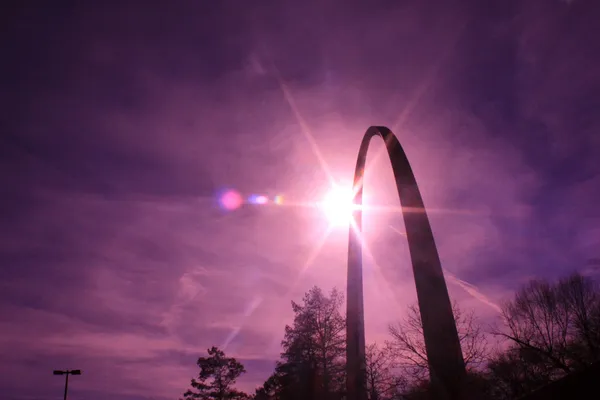
St. Louis residents are waking up to clear, sunny skies this Wednesday, January 21, 2026. After a cold start with overnight lows dipping to a freezing 24°F, the early morning hours are characterized by crisp air and bright sunlight. The humidity is hovering around 51%, making the air feel sharp but manageable for those heading out for the morning commute. While the mercury started low, the absence of cloud cover is allowing for a steady climb in temperatures through the early parts of the day.
Afternoon Highs and Evening Clouds
Conditions are expected to remain pleasant throughout the afternoon as we reach a predicted high of 47°F. This peak temperature is slightly above the historical average for late January, providing a much-needed break from the typical mid-winter deep freeze. Local meteorologists suggest that the afternoon will be the best time for outdoor activities or errands, as winds remain relatively calm. However, a transition is expected as we head into the evening hours. Cloud cover will begin to increase significantly after sunset, with the sky turning mostly cloudy by late tonight. Temperatures will drop back down into the low 30s as the humidity remains stable, signaling a shift in the local weather pattern.
Calm Before the 'Legendary' Winter Storm
While today’s weather is largely peaceful, the National Weather Service in St. Louis has issued a significant update regarding the days ahead. A Winter Storm Watch is currently in effect, and meteorologists are tracking a major winter storm that is expected to engulf a 2,000-mile stretch of the country. For St. Louis, the primary impacts are expected to begin late Friday into early Saturday morning. This system is being described by some experts as a "legendary winter storm setup," fueled by a polar vortex meeting an atmospheric river streaming from the Gulf of Mexico.
Weekend Warning and Preparation
Residents should use the clear conditions today to prepare for potentially hazardous wintry weather this weekend. Current predictions for the upcoming storm include the following alerts:
- Winter Storm Watch: In effect from 12 AM Saturday until 6 AM Sunday morning.
- Snow Accumulations: Preliminary forecasts suggest 3 to 6 inches of snow are possible, with higher amounts likely depending on the final track of the storm.
- Extreme Cold: Following the snow, temperatures are expected to plummet, with the potential for life-threatening cold reaching as low as minus-30°F in some parts of the Midwest.
Travel conditions are expected to become dangerous by the end of the week. Officials advise checking emergency kits and ensuring vehicles are winter-ready before the first flakes begin to fall. Enjoy the 47-degree sunshine today, St. Louis, as it may be the last mild afternoon for quite some time.