How racial, economic, political and geographic boundaries have shaped divisions across the St. Louis region
A longstanding question, rooted in history
Divisions across the St. Louis region are often described in terms of neighborhood lines, municipal borders and major corridors. Many of those boundaries reflect decisions and events that reshaped where people lived, where tax bases accumulated, and how public services were organized.
City–county separation and fragmented governance
One structural divide is governmental: St. Louis is an independent city, separate from St. Louis County. That arrangement traces to a separation vote in 1876 and the formal split in 1877. The result created two distinct jurisdictions—each with its own tax structures, service responsibilities and political institutions—alongside a metropolitan area that later expanded across numerous municipalities.
Housing segregation and the legal architecture of separation
Residential segregation has been reinforced over time through a mix of private and public mechanisms. A pivotal civil-rights case originating in St. Louis involved racially restrictive covenants—contract provisions that attempted to bar Black residents from occupying certain properties. In 1948, the U.S. Supreme Court held that courts could not enforce such covenants, a decision that curtailed one formal tool of exclusion while leaving entrenched residential patterns and unequal access to housing opportunities in place.
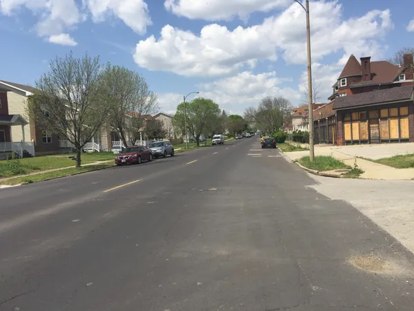
Delmar Boulevard as a widely cited dividing line
Within the city, Delmar Boulevard is frequently treated as a shorthand for disparities that track race and income. The term “Delmar Divide” has been used to describe sharp contrasts in neighborhood demographics, household resources and educational attainment north and south of the corridor. In practice, Delmar functions less as a cause by itself than as a visible boundary where broader patterns of investment, housing opportunity and access to high-performing institutions become geographically legible.
Schools as both a mirror and a mechanism of division
Education has also been a central arena for regional divides. A major school desegregation case involving St. Louis public schools began in 1972 and led to a court-approved settlement creating a voluntary interdistrict transfer program in 1983. That program enabled Black city students to attend participating suburban schools and white suburban students to attend city magnet schools, reflecting both the extent of segregation and a regional attempt to reduce it through voluntary transfers and magnet options.
Urban renewal, public housing, and displacement pressures
The built environment also reflects high-impact decisions about redevelopment. Pruitt–Igoe, a federally funded public-housing complex constructed in the 1950s on the city’s North Side, deteriorated rapidly amid rising vacancies and mounting maintenance problems. Demolition began with a widely publicized implosion in 1972, and the broader clearance continued into the mid-1970s. The episode remains a marker of how urban renewal, housing policy and municipal capacity intersected—often with lasting consequences for neighborhood stability.
- Key regional divides include jurisdictional fragmentation, housing segregation and uneven public investment.
- Education policy and school assignment patterns have repeatedly reflected and reinforced separation.
- Major redevelopment and housing decisions have left long-term geographic imprints on opportunity.
In St. Louis, boundaries are not only lines on a map; they often correspond to differences in governance, access to services, and long-term investment patterns.
As residents debate what divides the region today, the most durable lines tend to be those embedded in institutions—local government structures, housing markets and school systems—where the effects of past decisions remain visible in present-day outcomes.