Frigid Grip and Frozen Streets: St. Louis Navigates a Bitter Wednesday Recovery
Bitter Cold Grips the Gateway City
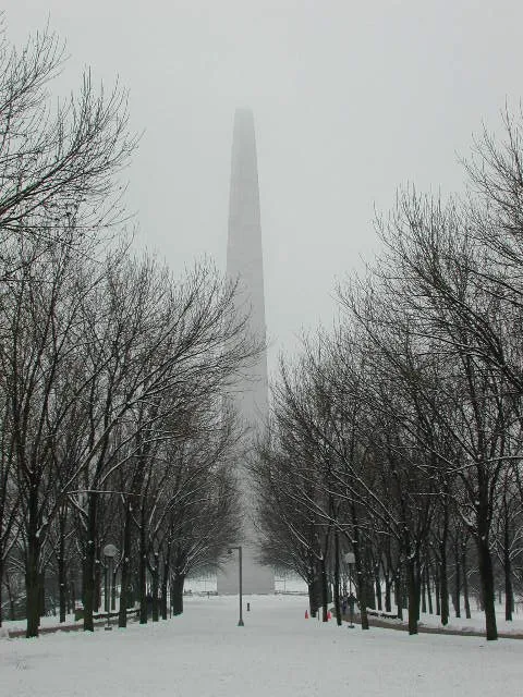
St. Louis remains locked in a deep freeze this Wednesday, January 28, 2026, as the region continues to dig out from the massive winter storm that hammered the Midwest over the weekend. With a State of Emergency still in effect, residents are waking up to some of the most dangerous temperatures of the season. Mayor Cara Spencer has urged citizens to limit outdoor exposure as city crews work around the clock to clear secondary routes and maintain emergency shelter capacity.
Morning: A Dangerous Start
The morning hours are characterized by a 'Cold Weather Advisory' from the National Weather Service. While the actual air temperature sits near 12°F, light winds are producing wind chill values between -10°F and -15°F. Skies are expected to be clear early on, providing a deceptively bright but biting start to the day. For those commuting, the primary concern remains the 'cocktail' of ice and packed snow left behind by the recent 5.1-inch record snowfall. Even with salt treatments, the extreme cold has made snow removal difficult, leaving many side streets treacherous.
Afternoon: Brief Reprieve with Partly Cloudy Skies
As we move into the afternoon, temperatures will climb to a projected high of 30°F. While this remains below freezing, the sun will provide a marginal reprieve from the morning's sub-zero wind chills. Cloud cover is expected to increase throughout the day, transitioning from sunny to partly cloudy by mid-afternoon. Humidity levels will hover around 69%, making the air feel crisp and dry. No significant precipitation is expected during daylight hours, allowing road crews a window of opportunity to continue recovery efforts.
Evening and Overnight: Clouds Return
The mercury will drop quickly after sunset, returning to a low of approximately 12°F. Cloud cover will thicken significantly by the evening hours, and there is a 10% chance of light snow flurries or 'icy pellets' late tonight. While no major accumulation is anticipated for the remainder of Wednesday, the persistent freezing temperatures mean that any melting that occurred during the day will refreeze into black ice, creating hazardous conditions for the Thursday morning commute.
Safety Alerts and City Notices
The city remains under a Level 4 'Code Blue' status, ensuring that over 1,000 emergency shelter beds are available for those in need. Residents are encouraged to check on neighbors and ensure pets are kept indoors. Key safety reminders for today include:
- Travel with Caution: Major corridors like I-70 and I-44 are mostly clear, but entrance ramps and residential streets remain slick.
- Protect Pipes: With temperatures staying continuously below freezing through the end of the week, keep faucets dripping to prevent pipe bursts.
- Emergency Declaration: The Mayor’s emergency declaration remains active through February 22, allowing the city additional resources for snow procurement and overtime costs.